Southwest Beaverton -Hillsdale Highway extends from left to right at bottom and is intersected by SW Laurelwood Avenue. The vacant land at lower left has been identified as the future site of Zupan's Market. SW Crestwood Drive is at the center; SW Whitepine Lane is at its left (west) and SW 83rd Avenue is at its right. The view looks northwest.
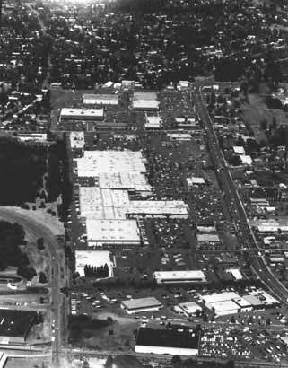
Bernard Mall, later known as Beaverton Mall, is now called Cedar Hills Crossing. Cedar Hills Boulevard paralells the shopping center. The view looks north.
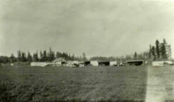
This is one of the earliest photos of Bernard Airport, which began operations about 1931. Cedar Street, now Cedar Hills Boulevard, parallels the airport on the right side.
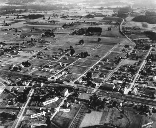
The bandstand was moved from Broadway Street when the Fisher Building was constructed. To the right of the bandstand is a small structure - City Hall. The large white wood building with the stairway is Ray Morse Hall. A little down from the center to the right is the two-story Cady Building on SW Farmington Avenue. SW Watson Avenue extends north to south, angling to the top of the photo. The view looks to the south.
SW Farmington Road bisects the photo left to right. A little left of center is the two-story brick Cady building, facing Farmington. Cedar Hills Boulevard intersects in the foreground. next to the old bank of Left of that is Broadway, with the long old brick building.
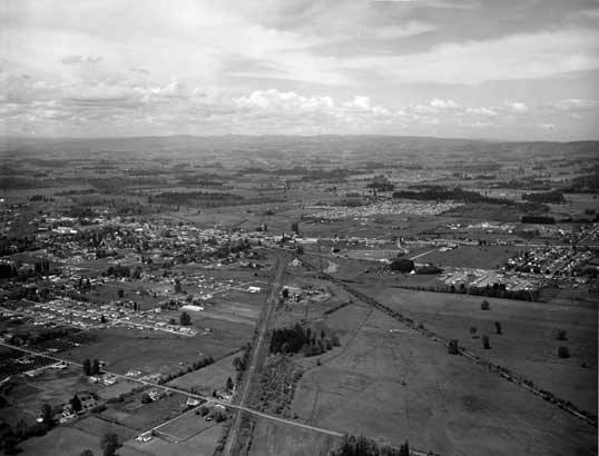
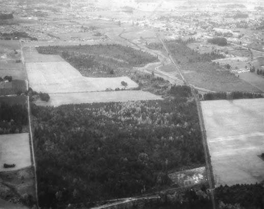
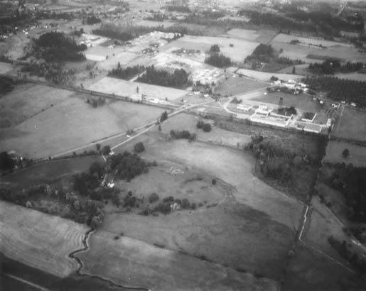
View looking southeast along the railroad tracks toward downtown Beaverton in upper right. Bernard Airfield is at upper left. Directly below at right is the St. Mary's electrical substation just west of Beaverton with high tension wires running north-south. The big open field in upper left is the site of the future Tektronix.
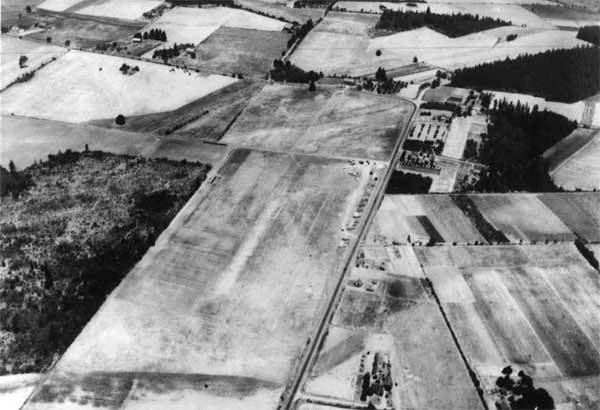
SW Hall Boulevard extends from left to right and is intersected by SW Scholls Ferry Road. The Fanno Farmhouse can be seen at lower left. The community of Progress is visible adjacent to the grove of trees at center right. The View-Master water tower can be seen.
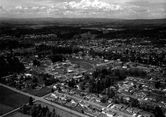
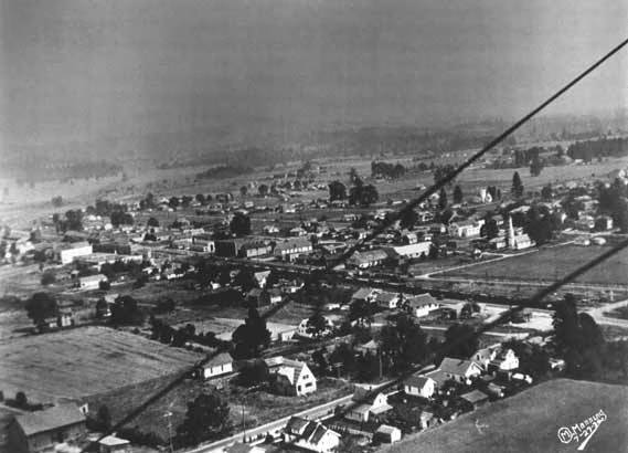
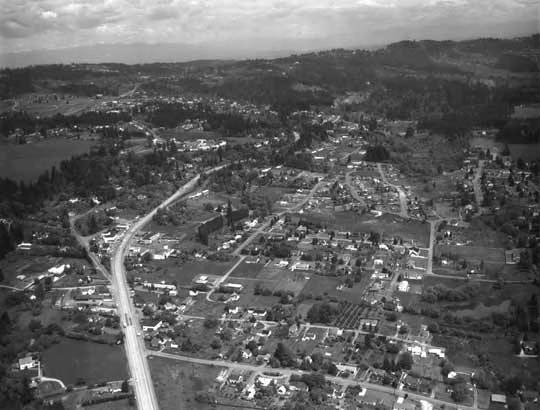
The view looks north. Beaverton High School is at far left, SW 12th Street is at bottom center from left to right, Bernard's Airfield is at upper left, and the future site of Beaverton Town Square is at center, far right. St. Cecelia Catholic church is also visible.
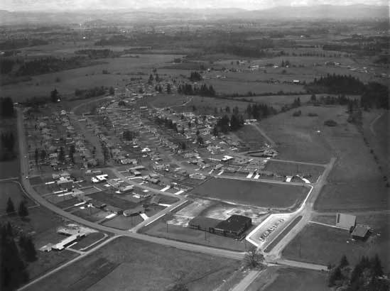
The large structure at lower right is the C.E. Mason School, named for a Beaverton physician who served nearly two decades on the Beaverton School District Board. He began his terms in 1917. The school was renamed Arts & Communication Academy in 1992.
The view looks west, towards Aloha. The 3-story building next to Tualatin Valley Highway was called the Main Building; it housed administration offices, classrooms, chapel, milk cellar, assembly hall, kitchen, and dining rooms for children, staff, priests and living quarters for older children and priests. To the north (at the left in the photo) and across two playing fields is gymnasium and pool. The building behind the barn is the barn for the working farm. The barn burned down in a spectacular fire. The children raised cows for milk, butter, ice cream, etc. The contributor of this information noted he had to mow the playing fields as part of his chores. Information contributed by Paul Paz, also known as The Paz Boys. in a spectacular fire. The children raised cows for milk, butter, ice cream, etc.
View looks southeast. SW Farmington Road extends left to right. The houses at the bottom right are on present-day Cedar Hills Boulevard. The two-story brick Cady Building is slightly left of center.
View looks east. SW Beaverton-Hillsdale Highway extends from lower left to upper right. SW Canyon Road is visible at far left. The field at lower left is the future site of Kaiser-Permanente. Further east also on the right side is the future site of Valley Plaza Shopping Center. Raleigh Hills can be seen towards the upper right.